
Baker, Oklahoma
Baker | |
|---|---|
 Baker Location within the state of Oklahoma  Baker Baker (the United States) | |
| Coordinates: 36°52′10″N 101°01′05″W / 36.86944°N 101.01806°W[1] | |
| Country | United States |
| State | Oklahoma |
| County | Texas |
| Elevation | 2,848 ft (868 m) |
| Time zone | UTC-6 (Central (CST)) |
| • Summer (DST) | UTC-5 (CDT) |
| ZIP codes | 73950 |
Baker is a small rural unincorporated community in northeastern Texas County, Oklahoma, United States, ¼ mile north of U.S. Route 64. Tyrone lies six miles to the north-northwest on US Route 54 and Turpin lies eight miles to the east at the intersection of Route 64 and US Route 83 in adjacent Beaver County.[2]
Originally named Bakerburg, the post office opened June 5, 1931. The name was changed to Baker August 15, 1953. The community is said to have been named for Rueben F. Baker.[3]
References
- ^ a b U.S. Geological Survey Geographic Names Information System: Baker, Oklahoma
- ^ Oklahoma Atlas & Gazeteer, DeLorme, 1st ed., 1998, p. 16 ISBN 0899332838
- ^ Shirk, George H., Oklahoma Place Names, Norman: University of Oklahoma Press, 1987, p. 16 ISBN 0-8061-2028-2
Municipalities and communities of Texas County, Oklahoma, United States | ||
|---|---|---|
| Cities | 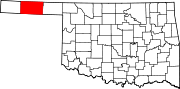 | |
| Towns | ||
| CDPs | ||
| Other communities | ||
This Oklahoma state location article is a stub. You can help Wikipedia by expanding it. |