
Browns Canon, Colorado
Browns Canon is an unincorporated community located near Browns Canyon National Monument in Chaffee County, Colorado.[1][2][3]
The GNIS gives three alternate spellings: Brown Canon, Browns Canyon, and Browns Cañon.[4]
References
- ^ "Browns Canon Populated Place Profile". HTL, Inc. Retrieved 28 April 2013.
- ^ "Browns Canon, United States". ITA. Retrieved 28 April 2013.
- ^ Sheppard, Kate (19 February 2015). "Obama Will Designate 3 New National Monuments". Huffington Post. Retrieved 19 February 2015.
- ^ "Browns Canon". Geographic Names Information System. United States Geological Survey, United States Department of the Interior.
Municipalities and communities of Chaffee County, Colorado, United States | ||
|---|---|---|
| City | 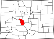 | |
| Towns | ||
| CDPs | ||
| Unincorporated communities | ||
38°36′43″N 106°03′36″W / 38.61194°N 106.06000°W
This Colorado-related article is a stub. You can help Wikipedia by expanding it. |