Bukama
Appearance
Bukama | |
|---|---|
 | |
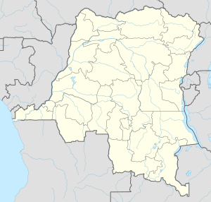
| Coordinates: 9°12′S 25°50′E / 9.200°S 25.833°E | |
| Country | |
| Province | Haut-Lomami |
| Elevation | 1,499 m (4,918 ft) |
| Population (2009) | |
• Total | 42,718 |
| Time zone | UTC+2 (Lubumbashi Time) |
| Climate | Aw |
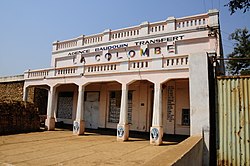
Bukama is a town in Haut-Lomami Province of south-eastern Democratic Republic of the Congo. As of 2009 it had an estimated population of 42,718.[2]
Climate
Köppen-Geiger climate classification system classifies its climate as a tropical savanna climate (Aw).[1]
| Climate data for Bukama | |||||||||||||
|---|---|---|---|---|---|---|---|---|---|---|---|---|---|
| Month | Jan | Feb | Mar | Apr | May | Jun | Jul | Aug | Sep | Oct | Nov | Dec | Year |
| Mean daily maximum °C (°F) | 29.8 (85.6) |
29.9 (85.8) |
30.7 (87.3) |
31.1 (88.0) |
31.8 (89.2) |
30.6 (87.1) |
31.3 (88.3) |
32.6 (90.7) |
34.0 (93.2) |
32.8 (91.0) |
31.5 (88.7) |
29.9 (85.8) |
31.3 (88.4) |
| Daily mean °C (°F) | 24.8 (76.6) |
24.9 (76.8) |
25.5 (77.9) |
25.5 (77.9) |
24.6 (76.3) |
22.6 (72.7) |
22.8 (73.0) |
24.3 (75.7) |
26.2 (79.2) |
26.2 (79.2) |
25.9 (78.6) |
24.9 (76.8) |
24.8 (76.7) |
| Mean daily minimum °C (°F) | 19.9 (67.8) |
20.0 (68.0) |
20.4 (68.7) |
20.0 (68.0) |
17.5 (63.5) |
14.6 (58.3) |
14.4 (57.9) |
16.1 (61.0) |
18.4 (65.1) |
19.6 (67.3) |
20.3 (68.5) |
20.0 (68.0) |
18.4 (65.2) |
| Average precipitation mm (inches) | 95 (3.7) |
77 (3.0) |
86 (3.4) |
39 (1.5) |
4 (0.2) |
0 (0) |
0 (0) |
2 (0.1) |
9 (0.4) |
34 (1.3) |
71 (2.8) |
88 (3.5) |
505 (19.9) |
| Source: Climate-Data.org, altitude: 1499m[1] | |||||||||||||

References
- ^ a b c "Climate: Bukama - Climate graph, Temperature graph, Climate table". Climate-Data.org. Retrieved 17 September 2013.
- ^ "Congo (Dem. Rep.): largest cities and towns and statistics of their population". World Gazetteer. Archived from the original on May 22, 2011. Retrieved January 21, 2009.

