Kukava
Appearance
Kukava | |
|---|---|
| Coordinates: 46°28′0.31″N 15°57′49.69″E / 46.4667528°N 15.9638028°E | |
| Country | |
| Traditional region | Styria |
| Statistical region | Drava |
| Municipality | Juršinci |
| Area | |
• Total | 2 km2 (0.8 sq mi) |
| Elevation | 300.7 m (986.5 ft) |
| Population (2002) | |
• Total | 208 |
| [1] | |
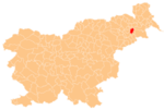
Kukava (pronounced [ˈkuːkaʋa]) is a settlement on the western edge of the Slovene Hills (Template:Lang-sl) in the Municipality of Juršinci in northeastern Slovenia. Traditionally the area was part Styria and is now included with the rest of the municipality in the Drava Statistical Region.[2]
A small chapel-shrine with a belfry in the settlement was built in 1931 on the site of an older church demolished in the late 18th century.[3]
References
External links


