
Lawson, Arkansas
Lawson, Arkansas | |
|---|---|
 Lawson, Arkansas  Lawson, Arkansas | |
| Coordinates: 33°11′48″N 92°28′59″W / 33.19667°N 92.48306°W | |
| Country | United States |
| State | Arkansas |
| County | Union |
| Elevation | 207 ft (63 m) |
| Time zone | UTC-6 (Central (CST)) |
| • Summer (DST) | UTC-5 (CDT) |
| ZIP code | 71750 |
| Area code | 870 |
| GNIS feature ID | 77460[1] |
Lawson is an unincorporated community in Union County, Arkansas, United States. Lawson was founded by Lawson Smith, who was born in 1813 and died in 1899. Lawson is located on Arkansas Highway 129, 10.5 miles (16.9 km) east of El Dorado. Lawson has a post office with ZIP code 71750.[2]
References
Municipalities and communities of Union County, Arkansas, United States | ||
|---|---|---|
| Cities | 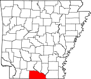 | |
| Town | ||
| CDPs | ||
| Other unincorporated communities | ||
This Arkansas state location article is a stub. You can help Wikipedia by expanding it. |