
Marshall, North Dakota
Marshall, North Dakota | |
|---|---|
 Marshall Location within the state of North Dakota  Marshall Marshall (the United States) | |
| Coordinates: 47°8′17″N 102°19′59″W / 47.13806°N 102.33306°W | |
| Country | United States |
| State | North Dakota |
| County | Dunn |
| Elevation | 1,982 ft (604 m) |
| Time zone | UTC-6 (Central (CST)) |
| • Summer (DST) | UTC-5 (CDT) |
| Area code | 701 |
| GNIS feature ID | 1030104 |
Marshall is an unincorporated community in southeastern Dunn County, North Dakota, United States. It lies along North Dakota Highway 8 east-southeast of the city of Manning, the county seat of Dunn County.[1] Its elevation is 1,982 feet (604 m).[2]
References
- ^ Rand McNally. The Road Atlas '08. Chicago: Rand McNally, 2008, p. 77.
- ^ U.S. Geological Survey Geographic Names Information System: Marshall, North Dakota, Geographic Names Information System, 1980-02-13. Accessed 2008-03-31.
Municipalities and communities of Dunn County, North Dakota, United States | ||
|---|---|---|
| Cities | 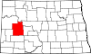 | |
| CDP | ||
| Other communities | ||
| Indian reservation | ||
| Footnotes | ‡This populated place also has portions in an adjacent county or counties | |
This North Dakota location article is a stub. You can help Wikipedia by expanding it. |