
Neshoba, Mississippi
Neshoba, Mississippi | |
|---|---|
 Neshoba, Mississippi  Neshoba, Mississippi | |
| Coordinates: 32°27′24″N 89°08′17″W / 32.45667°N 89.13806°W | |
| Country | United States |
| State | Mississippi |
| County | Neshoba |
| Elevation | 499 ft (152 m) |
| Time zone | UTC-6 (Central (CST)) |
| • Summer (DST) | UTC-5 (CDT) |
| ZIP code | 39350 |
| Area code | 601 |
| GNIS feature ID | 674558[1] |
Neshoba is an unincorporated community located in Neshoba County, Mississippi, United States. Neshoba is approximately 5.3 miles (8.5 km) north of Union along Mississippi Highway 15.
The community takes its name from the county in which it is located.[2]
References
- ^ U.S. Geological Survey Geographic Names Information System: Neshoba, Mississippi
- ^ Baca, Keith A. (2007). Native American Place Names in Mississippi. University Press of Mississippi. p. 62. ISBN 978-1-60473-483-6.
Municipalities and communities of Neshoba County, Mississippi, United States | ||
|---|---|---|
| Cities | 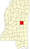 | |
| Town | ||
| CDPs | ||
| Other communities | ||
| Indian reservation | ||
| Footnotes | ‡This populated place also has portions in an adjacent county or counties | |
This Mississippi location article is a stub. You can help Wikipedia by expanding it. |