Arly
Appearance
| Arly | |
|---|---|
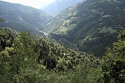
 The Arly Gorge near Cohennoz | |
 | |
| Location | |
| Country | France |
| Physical characteristics | |
| Source | |
| • location | Mégève |
| Mouth | |
• location | Isère in Albertville |
| Length | 35 km (22 mi) |
| Basin features | |
| Progression | Isère→ Rhône→ Mediterranean Sea |
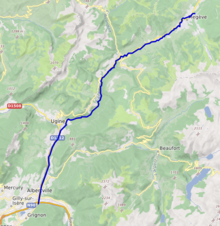
Arly is a 34.5 km long river in the departments of Savoie and Haute-Savoie, France.[1] It is a tributary of the Isère, which it joins at Albertville.
Towns crossed by the river
- Megève
- Praz-sur-Arly
- Flumet
- Saint-Nicolas-la-Chapelle
- Crest-Voland
- Héry-sur-Ugine
- Cohennoz
- Ugine
- Marthod
- Albertville
