
New Milton, West Virginia
New Milton, West Virginia | |
|---|---|
 New Milton Location within the state of West Virginia  New Milton New Milton (the United States) | |
| Coordinates: 39°13′48″N 80°40′57″W / 39.23000°N 80.68250°W | |
| Country | United States |
| State | West Virginia |
| County | Doddridge |
| Time zone | UTC-5 (Eastern (EST)) |
| • Summer (DST) | UTC-4 (EDT) |
| ZIP codes | 26411 |
New Milton is an unincorporated community in central Doddridge County, West Virginia, United States. The community is located along Meathouse Fork, southeast of the town of West Union, the county seat of Doddridge County.[1] Its elevation is 833 feet (254 m).[2][3] Although it is unincorporated, it has a post office, with the ZIP code of 26411.[4]
References
Citations
- ^ Rand McNally. The Road Atlas '08. Chicago: Rand McNally, 2008, p. 112.
- ^ U.S. Geological Survey Geographic Names Information System: New Milton, West Virginia, Geographic Names Information System, 1980-06-27. Accessed 2008-02-21.
- ^ The National Map, accessed 2013-12-14
- ^ Zip Code Lookup
Further reading
- Randolph, Roy F. (1926), History of New Milton Community, Doddridge County, West Virginia. Morgantown, West Virginia, Agricultural Extension Division.
Municipalities and communities of Doddridge County, West Virginia, United States | ||
|---|---|---|
| Town | 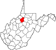 | |
| Unincorporated communities | ||
This article about a location in Doddridge County, West Virginia is a stub. You can help Wikipedia by expanding it. |