
Old Trap, North Carolina
Old Trap, North Carolina | |
|---|---|
rural community | |
| Nickname(s): Oldtrap, The Trap | |
| Country | United States |
| State | North Carolina |
| County | Camden |
| Elevation | 7 ft (2 m) |
| Time zone | Eastern (EST) |
36°14′27″N 76°01′37″W / 36.24083°N 76.02694°W Old Trap (also, Oldtrap and The Trap) is a rural community in Camden County, North Carolina, United States. It lies on North Carolina Highway 343, at an elevation of 7 feet (2.1 m) above sea level.
Old Trap was once called "The Trap" for the saloons the community contained which locals perceived as immoral.[1]
References
- ^ Lacey, Theresa Jensen (1 October 2002). Amazing North Carolina. Thomas Nelson Inc. p. 44. ISBN 978-1-4185-3840-8.
Municipalities and communities of Camden County, North Carolina, United States | ||
|---|---|---|
| City | 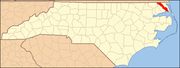 | |
| CDPs | ||
| Townships | ||
| Unincorporated community | ||
| Footnotes | ‡This populated place also has portions in an adjacent county or counties | |