Raynesford, Montana
Appearance

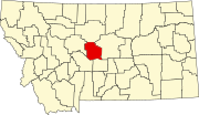
Raynesford is an unincorporated community in Judith Basin County, Montana, United States. Its elevation is 4,042 feet (1,232 m), and it is located at 47°16′12″N 110°43′48″W / 47.27000°N 110.73000°W (47.2699643, -110.7299417).[1] The community includes a community center, a catholic church, a fire department,[2] and a post office.[3] The post office was established under the name of "Spion Kop" on March 31, 1906; its name was changed to Raynesford exactly three years later.[3]
Climate
According to the Köppen Climate Classification system, Raynesford has a semi-arid climate, abbreviated "BSk" on climate maps.[4]
References
- ^ U.S. Geological Survey Geographic Names Information System: Raynesford, Montana
- ^ U.S. Geological Survey Geographic Names Information System: Judith Basin Rural Fire District Raynesford
- ^ a b U.S. Geological Survey Geographic Names Information System: Raynesford Post Office
- ^ Climate Summary for Raynesford, Montana
47°16′12″N 110°43′48″W / 47.27000°N 110.73000°W

