
Saint Bernard, Louisiana
Saint Bernard, Louisiana | |
|---|---|
 The Kenilworth Plantation House in Saint Bernard | |
 Saint Bernard, Louisiana  Saint Bernard, Louisiana | |
| Coordinates: 29°52′02″N 89°51′31″W / 29.86722°N 89.85861°W | |
| Country | United States |
| State | Louisiana |
| Parish | St. Bernard |
| Elevation | 3 ft (0.9 m) |
| Time zone | UTC-6 (Central (CST)) |
| • Summer (DST) | UTC-5 (CDT) |
| Area code | 504 |
| GNIS feature ID | 1628099[1] |
Saint Bernard is an unincorporated community in St. Bernard Parish, Louisiana, United States. The community is located on Louisiana State Highway 300, east of the Mississippi River and 8 miles (13 km) southeast of Chalmette.
Saint Bernard is home to four sites on the National Register of Historic Places: the Dr. Louis A. Ducros House, the Kenilworth Plantation House, Magnolia Mound, and the Sebastopol Plantation House.[2]
References
Municipalities and communities of St. Bernard Parish, Louisiana, United States | ||
|---|---|---|
| CDPs | 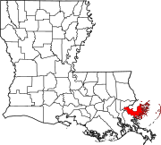 | |
| Other communities | ||
| Ghost towns | ||
This Louisiana state location article is a stub. You can help Wikipedia by expanding it. |