Xenia, Kansas
Xenia, Kansas | |
|---|---|
 | |
| Coordinates: 37°59′43″N 94°59′11″W / 37.99528°N 94.98639°W[1] | |
| Country | United States |
| State | Kansas |
| County | Bourbon |
| Founded | 1858 |
| Elevation | 1,047 ft (319 m) |
| Time zone | UTC-6 (CST) |
| • Summer (DST) | UTC-5 (CDT) |
| Area code | 620 |
| FIPS code | 20-80600 [1] |
| GNIS ID | 474541 [1] |
Xenia is an unincorporated community in Franklin Township, Bourbon County, Kansas, United States.[1][2]
History
Settling in the Xenia area in 1856, the year after Bourbon County was organized in 1855, were John Van Syckle, Samuel Stephenson and Charles Anderson.[3]
John Van Syckle and his father laid out Xenia's village plat in 1858.[4] The community was named after Xenia, Ohio.[5] The younger Van Syckle opened the village's first store, offering general merchandise.[3]
Xenia gained a post office on November 29, 1858, when the Peru (Linn County) post office was moved to Xenia. Peru, which is now a ghost town, had a post office from August 5 to November 29, 1858.[6] As well as being Xenia's first merchant, John Van Syckle became Xenia's first postmaster.[7]
The first church building was built in 1876 by the Methodists.[3]
In 1878, Franklin township was Bourbon County's fourth-most populous, at 1,474. The county seat of Fort Scott had 5,081 residents. Scott Township had 2,036. Marion Township, just south of Franklin in the county's west end, had 1,676.[3]
In 1910, Xenia had a money-order post office and population of 115.[8] Xenia Post Office closed Aug. 31, 1926.[9]
Geography
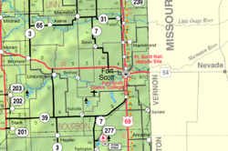
Located at an altitude of 1,047 feet (317 m),[1] it lies in Bourbon County's northwest corner, along K-65, west of the confluence of the Little Osage River and Limestone Creek, about 18 miles northwest of Fort Scott.[2]
Further reading
References
- ^ a b c d e f Geographic Names Information System (GNIS) details for Xenia, Kansas; United States Geological Survey (USGS); October 13, 1978.
- ^ a b DeLorme. Kansas Atlas & Gazetteer. 4th ed. Yarmouth: DeLorme, 2009, p. 66. ISBN 0-89933-342-7.
- ^ a b c d "Archived copy". Archived from the original on May 9, 2013. Retrieved March 16, 2013.
{{cite web}}: CS1 maint: archived copy as title (link) - ^ http://www.kancoll.org/books/cutler/bourbon/bourbon-co-p24.html
- ^ "Many Towns Have Disappeared (Note: Page loads on 9C due to technical constraints. Scroll to next page)". The Fort Scott Tribune. July 16, 1976. pp. 10C. Retrieved 16 May 2015.
- ^ Robert W. Baughman's Kansas Post Offices, May 29, 1828-August 3, 1961, published by the Kansas Postal History Society, an affiliate of the Kansas Historical Society.
- ^ http://www.kansasmemory.org/item/223977/page/8/ Kansas Historical Society, Kansas Memory records
- ^ "Kansas, a cyclopedia of state history ..." "Archived copy". Archived from the original on May 4, 2011. Retrieved January 11, 2011.
{{cite web}}: CS1 maint: archived copy as title (link) - ^ Robert W. Baughman's Kansas Post Offices, May 29, 1828-August 3, 1961, published by the Kansas Postal History Society, an affiliate of the Kansas Historical Society.
External links
- Grand Lodge of Kansas A.F.&A.M.
- Xenia Baptist Church
- Xenia history in 1912
- Bourbon County Maps: Current, Historic - KDOT

