
Yale, Virginia
Yale, Virginia | |
|---|---|
 Yale, Virginia  Yale, Virginia | |
| Coordinates: 36°50′45″N 77°17′15″W / 36.84583°N 77.28750°W | |
| Country | United States |
| State | Virginia |
| County | Sussex |
| Elevation | 108 ft (33 m) |
| Time zone | UTC−5 (Eastern (EST)) |
| • Summer (DST) | UTC−4 (EDT) |
| ZIP code | 23897 |
| Area code | 434 |
| GNIS feature ID | 1477738[1] |
Yale is an unincorporated community in rural Sussex County, Virginia, United States.[1] Its ZIP code is 23897.[2]
Hunting Quarter Plantation
The historic Hunting Quarter Plantation, is located near Yale. Hunting Quarter, was built after 1745 by Captain Henry Harrison who fought in the French and Indian War. Captain Harrison was a brother of Benjamin Harrison V, the signer of the Declaration of Independence, and uncle of President William Henry Harrison (1774-1841). "Hunting Quarter" remained in the possession of the Harrison family until 1887. Hunting Quarter is listed on the National Register of Historic Places.
Notes
- ^ a b "Yale, Virginia". Geographic Names Information System. United States Geological Survey, United States Department of the Interior.
- ^ United States Postal Service (2012). "USPS - Look Up a ZIP Code". Retrieved 2012-02-15.
Municipalities and communities of Sussex County, Virginia, United States | ||
|---|---|---|
| Towns | 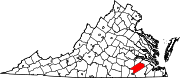 | |
| CDP | ||
| Unincorporated communities | ||
| Footnotes | ‡This populated place also has portions in an adjacent county or counties | |
This Sussex County, Virginia state location article is a stub. You can help Wikipedia by expanding it. |