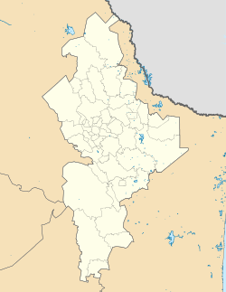
Iturbide, Nuevo León
Iturbide | |
|---|---|
| Coordinates: 24°43′31″N 99°54′00″W / 24.72528°N 99.90000°W | |
| Country | |
| State | Nuevo León |
| Government | |
| • Type | Municipality |
| • Mayor | José Antonio González |
| Area | |
| • Total | 719.2 km2 (277.7 sq mi) |
| Population (2010) | |
| • Total | 1,896 |
| • Density | 2.6/km2 (6.8/sq mi) |
| Time zone | UTC-6 (CST) |
| • Summer (DST) | UTC-5 (CDT) |
| Website | www |
Iturbide is a municipality of Mexico, located in Nuevo León. It has an area of 719.2 square kilometers. It is named in honor of Agustín de Iturbide. It is bordered by the municipality of Galeana on the north and west. Aramberri borders it to the south, and both Linares and Tamaulipas border it to the east. Its main economic activities are agriculture and tourism. The nearby municipal government center is San Pedro de Iturbide.
References
External links


