
Skaudvilė
This article needs additional citations for verification. (November 2016) |
Skaudvilė | |
|---|---|
City | |
 | |
 Coat of arms | |
 Skaudvilė Location of Skaudvilė | |
| Coordinates: 55°24′27″N 22°34′57″E / 55.40750°N 22.58250°E | |
| Country | Lithuania |
| Ethnographic region | Samogitia |
| County | Tauragė County |
| Municipality | Tauragė district municipality |
| Eldership | Skaudvilė eldership |
| Capital of | Skaudvilė eldership |
| First mentioned | 1760 |
| Granted city rights | 1950 |
| Population (2005) | |
| • Total | 2,081 |
| Time zone | UTC+2 (EET) |
| • Summer (DST) | UTC+3 (EEST) |
Skaudvilė (, Samogitian: Skaudvėlė, Polish: Skaudwile) is a city in the Tauragė district municipality of Lithuania. It is located 26 km (16 mi) north-east of Tauragė.
History
During the Second World War, in August 1941, the Jewish community of the town was massacred in a mass execution perpetrated by an einsatzgruppen. 300 Jews were killed.[1]
Gallery
-
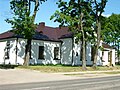 Skaudvilė police station
 -
 Skaudvilė special school
 -
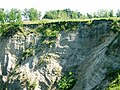 Exposures in Skaudvilė
 -
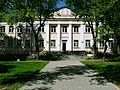
 Skaudvilė gymnasium


References
Wikimedia Commons has media related to Skaudvilė.

This Lithuanian location article is a stub. You can help Wikipedia by expanding it. |