Governor's Harbour Airport
Appearance
Governor's Harbour Airport | |||||||||||
|---|---|---|---|---|---|---|---|---|---|---|---|
| Summary | |||||||||||
| Airport type | Public | ||||||||||
| Location | Governor's Harbour, Bahamas | ||||||||||
| Elevation AMSL | 26 ft / 8 m | ||||||||||
| Coordinates | 25°17′05″N 076°19′52″W / 25.28472°N 76.33111°W | ||||||||||
| Map | |||||||||||
| Runways | |||||||||||
| |||||||||||
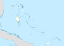
Governor's Harbour Airport is an airport in Governor's Harbour on Eleuthera in the Bahamas (IATA: GHB, ICAO: MYEM). It is the second most active of the three airports on Eleuthera, and is about 8 mi (13 km) north of the city.
Airlines and destinations
| Airlines | Destinations |
|---|---|
| Aztec Airways | Charter: Fort Lauderdale–Executive |
| Bahamasair | Nassau |
| Pineapple Air | Nassau |
| Silver Airways | Seasonal: Fort Lauderdale |
| Southern Air Charter | Nassau |
References

