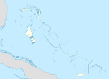
San Andros Airport
San Andros Airport | |||||||||||
|---|---|---|---|---|---|---|---|---|---|---|---|
| Summary | |||||||||||
| Airport type | Public | ||||||||||
| Serves | Nicholls Town, Andros Island, Bahamas | ||||||||||
| Hub for | Passenger | ||||||||||
| Elevation AMSL | 5 ft / 2 m | ||||||||||
| Coordinates | 25°03′14″N 078°02′56″W / 25.05389°N 78.04889°W | ||||||||||
| Map | |||||||||||
| Runways | |||||||||||
| |||||||||||
San Andros Airport (IATA: SAQ, ICAO: MYAN) is an airport near Nicholls Town on Andros Island in The Bahamas.[2]
Facilities
The airport resides at an elevation of 5 ft (1.5 m) above mean sea level. It has one runway designated 12/30 with a bitumen surface measuring 1,524 m × 23 m (5,000 ft × 75 ft).[1]
The airport has services from Westernair, Bahamasair, Lynx (from Fort Lauderdale) and other small twin engine charter planes that run between the islands.
Since November 2006, the airport has Av Gas and Jet A available from Westernair. The newly built Western Executive Jet Center has big screen TV, executive style bathrooms, conference rooms, pilot lounges, passenger area, delicatessen, and a VIP lounge. They also have a maintenance hangar for their aircraft and executive planes and a terminal for domestic flights.
Airlines and destinations
Scheduled passenger service from this airport is provided by the following airlines:
| Airlines | Destinations |
|---|---|
| AirExpress | Nassau |
| Western Air | Nassau |
References
- ^ a b Template:WAD
- ^ a b Airport information for SAQ at Great Circle Mapper. Source: DAFIF (effective October 2006).
External links
- Westernair, official site
- Airport information for MYAN at AirNav
- Accident history for SAQ at Aviation Safety Network

