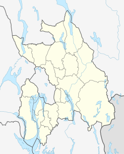
Fosser
Appearance
Fosser | |
|---|---|
Village | |
| Coordinates: 59°49′N 11°29′E / 59.817°N 11.483°E | |
| Country | Norway |
| County | Akershus |
| District | Romerike |
| Municipality | Aurskog-Høland |
| Area | |
• Total | 0.71 km2 (0.27 sq mi) |
| Population (2007)[1] | |
• Total | 578 |
| Time zone | UTC+1 (CET) |
| • Summer (DST) | UTC+2 (CEST) |
| Postal code | 1963 |
Fosser is a village in the municipality of Aurskog-Høland, Norway. Its population (2007) is 578. Fosser had a station on the Urskog-Hølandsbanen from the opening of the Hølandsbanen in 1898 and until the line was closed down in 1960.
The village derives its name from the local waterfall (waterfall = foss in Norwegian). The waterfall flows from the lake "Øversjøen" into "Fossersjøen" this lake is locally known for large Pike.

