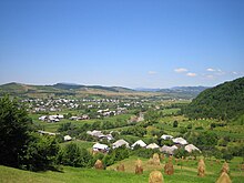
Lăpuș Mountains
Appearance

The Lăpuș Mountains (Romanian: Munții Lăpușului, Hungarian: Lápos-hegység) are a group of mountains in the Eastern Carpathians, located in the northern Romanian regions of Maramureș and Bukovina. The maximum elevation of these mountains is around 1,800m[1] and a river also with the name[2] Lăpuş runs through the valley.[3][4][5]

References
- ^ ARDELEAN, Amalia. "VEGETATION ASPECTS IN THE LAPUS REGION" (PDF). www.facultateadeinginerie.ro. Retrieved 2 September 2013.
- ^ "The Land of Lăpuş". www.romanianmonasteries.org. Retrieved 2 September 2013.
- ^ "Archived copy". Archived from the original on 2013-09-02. Retrieved 2013-09-02.
{{cite web}}: CS1 maint: archived copy as title (link) - ^ http://www.geolocation.ws/v/P/14908541/lapus-mountains-in-autumn/en
- ^ http://www.summitpost.org/prislop-rock-lapus-mountains/684215
