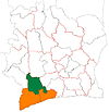
Buyo, Ivory Coast
Appearance
Buyo | |
|---|---|
City, sub-prefecture, and commune | |
| Coordinates: 6°14′N 7°3′W / 6.233°N 7.050°W[1] | |
| Country | |
| District | Bas-Sassandra |
| Region | Nawa |
| Department | Buyo |
| Population (2014)[2] | |
| • Total | 103,217 |
| Time zone | UTC+0 (GMT) |
Buyo is a city in south-western Ivory Coast. It is a sub-prefecture of and the seat of Buyo Department in Nawa Region, Bas-Sassandra District. Buyo is also a commune. The city sits on the south shore of Lake Buyo.
The far southern portion of the sub-prefecture is located in Taï National Park.
In 2014, the population of the sub-prefecture of Buyo was 103,217.[3]
Villages
The xx villages of the sub-prefecture of Buyo and their population in 2014 are:[3]
- Assamoikro (4 104 )
- Buyo (25 339 )
- Gbily (3 997 )
- Logbozoua (5 341 )
- Mayakoffikro (5 804 )
- Adk (Complexe Industriel) (2 771)
- Baglo 2 (5 097 )
- Dafrahinou (10 150 )
- Gbliglo (10 403 )
- Koréahinou (9 948 )
- Noukpoudou 2 (4 803 )
- Tchétaly (8 994 )
- Wonséaly (6 466 )
References
- ^ "Ivory Coast Cities Longitude & Latitude". sphereinfo.com. Archived from the original on 13 September 2012. Retrieved 18 November 2010.
- ^ "Côte d'Ivoire". geohive.com. Retrieved 7 December 2015.
- ^ a b "RGPH 2014, Répertoire des localités, Région Nawa" (PDF). ins.ci. Retrieved 5 August 2019.


