Kamanová

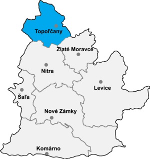
Kamanová is a municipality in the Topoľčany District of the Nitra Region, Slovakia.[1] In 2011 it had 601 inhabitants.[2]
See also
References
- ^ http://en.e-obce.sk/obec/kamanova/kamanova.html
- ^ "Archived copy" (PDF). Archived from the original (PDF) on 2013-10-12. Retrieved 2012-08-09.
{{cite web}}: CS1 maint: archived copy as title (link)
Genealogical resources
The records for genealogical research are available at the state archive "Statny Archiv in Nitra, Slovakia"
- Roman Catholic church records (births/marriages/deaths): 1758-1895 (parish B)
- Lutheran church records (births/marriages/deaths): 1708-1895 (parish B)
External links
- http://en.e-obce.sk/obec/kamanova/kamanova.html
- Official homepage
- Surnames of living people in Kamanova
48°28′N 18°06′E / 48.467°N 18.100°E
