Isumrud Strait

Coordinates: 4°49′S 145°53′E / 4.82°S 145.88°E / -4.82; 145.88
From Wikipedia, the free encyclopedia

This is an old revision of this page, as edited by Kwamikagami (talk | contribs) at 08:23, 2 April 2020 (removed Category:Nabigasyon sa Madang Province; added Category:Straits of Papua New Guinea using HotCat). The present address (URL) is a permanent link to this revision, which may differ significantly from the current revision.

Isumrud Strait
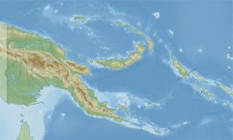
Isumrud Strait is located in Papua New Guinea
Isumrud Strait
Isumrud Strait
Isumrud Strait in PNG
Location Papua New Guinea, Madang Province
Coordinates4°49′S 145°53′E / 4.82°S 145.88°E / -4.82; 145.88
IslandsKarkar Island

Isumrud Strait is the strait separating Karkar Island from mainland New Guinea in Madang Province, Papua New Guinea.[1] It's 500 km from Port Moresby.

See also

References

  1. ^ Isumrud Strait at Geonames.org (cc-by); post updated 2011-06-05; database download sa 2015-06-22