Wylye
| Wylye | |
|---|---|
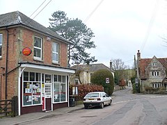
 Wylye Post Office | |
Location within Wiltshire | |
| Population | 412 (in 2011)[1] |
| OS grid reference | SU008377 |
| Civil parish |
|
| Unitary authority | |
| Ceremonial county | |
| Region | |
| Country | England |
| Sovereign state | United Kingdom |
| Post town | Warminster |
| Postcode district | BA12 |
| Dialling code | 01985 |
| Police | Wiltshire |
| Fire | Dorset and Wiltshire |
| Ambulance | South Western |
| UK Parliament | |
Wylye (/ˈwaɪli/) is a village and civil parish on the River Wylye in Wiltshire, England. The village is about 9+1⁄2 miles (15 km) northwest of Salisbury and a similar distance southeast of Warminster.
The civil parish includes the hamlet of Deptford, formerly a separate manor.[2] Today Deptford is the junction of two primary roads, the A303 (London to the southwest) and the A36 (Southampton to Bristol). In 1934 half of Fisherton parish was added to Wylye, including the small village of Fisherton Delamere.
Amenities
The Church of England parish church of St Mary the Virgin is Grade II* listed.[3] The church has 13th-century origins but was rebuilt in 1846 to designs by T.H. Wyatt and D. Brandon.[4]
A Congregational chapel was built in Wylye village in 1860 and closed in 2001.[5]
There is no school in the parish; the nearest primary school is at Codford. A National School was built near the church in 1873, superseding an earlier building. In 1938 children aged 11 and over were transferred to Wilton and the school closed in 1973 owing to the small number of pupils.[6]
The parish has a village hall.[7]
Railway
The Salisbury branch line was built through the Wyle valley in 1856 by the Great Western Railway, passing close to the south of Wylye village. Wylye station was sited where the railway crossed the road to Dinton. The station was closed in 1955 when local passenger services were withdrawn; the line continues in use as part of the Wessex Main Line.
Notable residents
W. H. Allen (1863-1943), landscape watercolour artist, lived in the parish from 1932. Michael Dobbs (born 1948), Baron Dobbs of Wylye, Conservative politician and author, lives in the parish.
Wylye Hoard
A collection of Bronze Age jewellery was found near the village by metal detectorists in 2012, and is now held by Salisbury Museum.[8]
References
- ^ "Wiltshire Community History - Census". Wiltshire Council. Retrieved 11 August 2015.
- ^ "Victoria County History - Wiltshire - Vol 15 - pp295-305 - Parishes: Wylye". British History Online. University of London. Retrieved 13 August 2015.
- ^ Historic England. "Church of St Mary, Wylye (1146203)". National Heritage List for England. Retrieved 12 August 2015.
- ^ "Church of St. Mary, Wylye". Wiltshire Community History. Wiltshire Council. Retrieved 12 August 2015.
- ^ "Congregational Chapel, Wylye". Wiltshire Community History. Wiltshire Council. Retrieved 12 August 2015.
- ^ "Church of England Elementary School, Wylye". Wiltshire Community History. Wiltshire Council. Retrieved 12 August 2015.
- ^ "Wylye Village Hall". Retrieved 12 August 2015.
- ^ "Jewellery hoard declared treasure". BBC News. 11 February 2014. Retrieved 31 August 2018.
External links
![]() Media related to Wylye at Wikimedia Commons
Media related to Wylye at Wikimedia Commons

