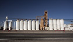
Olton, Texas
Olton, Texas | |
|---|---|
City | |
 Olton Grain Cooperative | |
| Coordinates: 34°11′00″N 102°08′05″W / 34.18333°N 102.13472°W | |
| Country | |
| State | |
| County | Lamb |
| Region | Llano Estacado |
| Established | 1906 |
| Elevation | 3,612 ft (1,101 m) |
| Population (2010) | |
| • Total | 2,215 |
| Time zone | UTC-6 (CST) |
| ZIP code | 79064 |
| Area code | 806 |
| Website | Handbook of Texas |
Olton is a city in Lamb County, Texas, United States. The population was 2,215 at the 2010 census.[2]
Geography
Olton is located at 34°11′00″N 102°08′05″W / 34.18333°N 102.13472°W (34.1834142 -102.1346258).[3] Olton was founded in 1906.
According to the United States Census Bureau, the city has a total area of 1.4 square miles (3.6 km2), all of it land.
Demographics
| Census | Pop. | Note | %± |
|---|---|---|---|
| 1930 | 687 | — | |
| 1940 | 782 | 13.8% | |
| 1950 | 1,201 | 53.6% | |
| 1960 | 1,917 | 59.6% | |
| 1970 | 1,782 | −7.0% | |
| 1980 | 2,235 | 25.4% | |
| 1990 | 2,116 | −5.3% | |
| 2000 | 2,288 | 8.1% | |
| 2010 | 2,215 | −3.2% | |
| 2018 (est.) | 2,104 | [4] | −5.0% |
| U.S. Decennial Census[5] | |||
As of the census[6] of 2000, 2,288 people, 742 households, and 571 families resided in the city. The population density was 1,683.8 people per square mile (649.6/km²). The 852 housing units averaged 627.0 per square mile (241.9/km²). The racial makeup of the city was 66.56% White, 2.01% African American, 1.31% Native American, 0.09% Asian, 27.49% from other races, and 2.53% from two or more races. Hispanics or Latinos of any race were 64.51% of the population.
Of the 742 households, 42.3% had children under the age of 18 living with them, 59.6% were married couples living together, 11.7% had a female householder with no husband present, and 23.% were not families. About 20.9% of all households were made up of individuals, and 11.3% had someone living alone who was 65 years of age or older. The average household size was 2.99 and the average family size was 3.47.
In the city, the population was distributed as 33.9% under the age of 18, 7.6% from 18 to 24, 23.3% from 25 to 44, 18.7% from 45 to 64, and 16.6% who were 65 years of age or older. The median age was 32 years. For every 100 females, there were 97.1 males. For every 100 females age 18 and over, there were 84.2 males.
The median income for a household in the city was $24,010, and for a family was $25,926. Men had a median income of $22,358 versus $18,833 for women. The per capita income for the city was $10,189. About 21.4% of families and 24.9% of the population were below the poverty line, including 28.6% of those under age 18 and 21.8% of those age 65 or over.
Education
The City of Olton is served by the Olton Independent School District.
Media
The local weekly newspaper is the Olton Enterprise.[7]
Notable people
- Jimmy Dean, American country music singer, actor, television host, and businessman
- Dawn DeBerry Stump, businesswoman and government official
- Peggy Sue Gerron, inspiration for the Buddy Holly song "Peggy Sue"
Climate
According to the Köppen climate classification, Olton has a semiarid climate, BSk on climate maps.[8]
See also
References
- ^ "Olton". Geographic Names Information System. United States Geological Survey, United States Department of the Interior.
- ^ "Profile of General Population and Housing Characteristics: 2010 Demographic Profile Data (DP-1): Olton city, Texas". United States Census Bureau. Retrieved January 26, 2012.
- ^ "US Gazetteer files: 2010, 2000, and 1990". United States Census Bureau. 2011-02-12. Retrieved 2011-04-23.
- ^ "Population and Housing Unit Estimates". Retrieved December 19, 2019.
- ^ "Census of Population and Housing". Census.gov. Retrieved June 4, 2015.
- ^ "U.S. Census website". United States Census Bureau. Retrieved 2008-01-31.
- ^ "Olton Enterprise". Olton Enterprise. Retrieved 17 March 2018.
- ^ Climate Summary for Olton, Texas


