
Winden, Germersheim
Winden | |
|---|---|
 Coat of arms | |
Location of Winden within Germersheim district 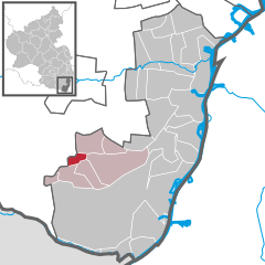 | |
 Winden  Winden | |
| Coordinates: 49°05′58″N 08°06′50″E / 49.09944°N 8.11389°E | |
| Country | Germany |
| State | Rhineland-Palatinate |
| District | Germersheim |
| Municipal assoc. | Kandel |
| Government | |
| • Mayor | Peter Beutlin (SPD) |
| Area | |
| • Total | 3.21 km2 (1.24 sq mi) |
| Elevation | 143 m (469 ft) |
| Population (2022-12-31)[1] | |
| • Total | 1,104 |
| • Density | 340/km2 (890/sq mi) |
| Time zone | UTC+01:00 (CET) |
| • Summer (DST) | UTC+02:00 (CEST) |
| Postal codes | 76872 |
| Dialling codes | 06349 |
| Vehicle registration | GER |
| Website | vg-kandel.de |
Winden is a municipality in the district of Germersheim, in Rhineland-Palatinate, Germany.
References
- ^ "Bevölkerungsstand 2022, Kreise, Gemeinden, Verbandsgemeinden" (PDF) (in German). Statistisches Landesamt Rheinland-Pfalz. 2023.
| International | |
|---|---|
| National | |
This Germersheim district location article is a stub. You can help Wikipedia by expanding it. |