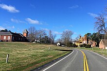
New Kent, Virginia
Appearance


New Kent is a census-designated place (CDP) in and the county seat of New Kent County, Virginia, United States.[1] The population as of the 2010 Census was 239.[2]
Cumberland Landing, Cumberland Plantation, and the Cumberland Marsh Natural Area Preserve are near New Kent.
Criss Cross and St. Peter's Church are listed on the National Register of Historic Places, and New Kent High School and George W. Watkins High School are National Historic Landmarks.[3]
See also
References
- ^ "Find a County". National Association of Counties. Retrieved 2011-06-07.
- ^ Virginia Trend Report 2: State and Complete Places (Sub-state 2010 Census Data). Archived 2012-07-11 at archive.today Missouri Census Data Center. Accessed 2011-06-08.
- ^ "National Register Information System". National Register of Historic Places. National Park Service. July 9, 2010.
37°31′04″N 76°58′44″W / 37.51778°N 76.97889°W

