Metropolis (Perrhaebia)
39°37′33″N 22°40′53″E / 39.62583°N 22.68139°E

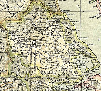
Metropolis (Template:Lang-grc) was a town in Perrhaebia in Ancient Thessaly. Stephanus of Byzantium calls it simply a town in Thessaly, distinct from its more-renowned namesake. This appears to be the Metropolis mentioned by Livy in his account of the campaign of Antiochus III, in 191 BCE, where it is related that the Syrian king having landed at Demetrias, first took Pherae, then Crannon, then Cypaera, Metropolis, and all the neighbouring fortresses, except Atrax and Gyrton, and afterwards proceeded to Larissa.[1] From this account it would appear that this Metropolis was in Perrhaebia; and its site has been discovered by William Martin Leake, near that of Atrax, at Kastri village in the municipal unit of Lakereia,[2] where the name of Μητροπολίτης occurs in an inscription.[3]
References
- ^ Livy. Ab urbe condita Libri [History of Rome]. Vol. 36.10.
- ^ Metropolis (Perrhaebia) can be found at GEOnet Names Server, at this link, by opening the Advanced Search box, entering "-819373" in the "Unique Feature Id" form, and clicking on "Search Database".
- ^ Leake, Travels in Northern Greece, vol. iii. p. 371.
![]() This article incorporates text from a publication now in the public domain: Smith, William, ed. (1854–1857). "Metropolis". Dictionary of Greek and Roman Geography. London: John Murray.
This article incorporates text from a publication now in the public domain: Smith, William, ed. (1854–1857). "Metropolis". Dictionary of Greek and Roman Geography. London: John Murray.
