Garrison Tower
Appearance
| Garrison Tower | |
|---|---|
 Garrison Tower in 2008 | |
| General information | |
| Coordinates | 49°54′45.1″N 6°19′20.72″W / 49.912528°N 6.3224222°W |
| Designations | Grade II listed[1] |
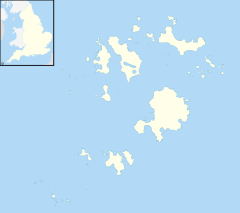
Garrison Tower is a Grade II listed structure on St Mary's, Isles of Scilly
The tower was built in the 17th century as a windmill. By 1750 it was abandoned and in a ruined condition. The remains were converted to a lookout tower in the 1830s by HM Coastguard.
In 1869, the Shipping and Mercantile Gazette obtained it as a lookout post to report shipping movements. It was taken over by Lloyd's of London in 1871.[2]
References
- ^ Historic England, "Garrison Tower (1328847)", National Heritage List for England, retrieved 7 October 2017
- ^ Goodwin, J (1993). "Granite towers on St Mary's, Isles of Scilly". Cornish Archaeology. 32: 128–139.

