Matatā
Matata | |
|---|---|
Town | |
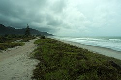
 Matata beach | |
| Coordinates: 37°53′S 176°45′E / 37.883°S 176.750°E | |
| Country | |
| Region | Bay of Plenty |
| Territorial authority | Whakatane District |
| Ward | Rangitaiki |
| Population (2013) | |
| • Total | 642 |
Matatā is a town in the Bay of Plenty in the North Island of New Zealand, 24 kilometres (15 mi) to the north-west of Whakatāne.
History and culture
Recent history
In 2005 the town was inundated by two debris flows from the Awatarariki and Waitepuru Streams that devastated a number of buildings, but did not cause any casualties. The debris flows were caused by a band of intense rain, at a rate of over 2 mm per minute, that fell into the catchments southwest of Matata, dislodging a huge amount of debris that had built up behind a temporary dam.[1]
From January 2005 the area was subject to hundreds of shallow, low intensity earthquakes, with the most intense swarms occurring in 2005 and 2007, but continuing to at least February 2009. The largest event was of magnitude 4.2 in May 2007.[2][3]
In 2016, scientists discovered a large amount of volcanic activity, including "an inflating magma" buildup, 10 kilometres (6.2 mi) below the surface of the town.[4] In 2019, the name of the town was officially gazetted as "Matatā".[5]
Marae
- Iramoko Marae and Te Paetata meeting house, affiliated with the Ngāti Awa hapū of Te Tāwera.
- Ngāti Umutahi Marae and Umutahi meeting house, affiliated with the Ngāti Tūwharetoa hapū of Ngāti Iramoko, Ngāti Umutahi and Te Tāwera.
- Ōniao Marae Tūwharetoa meeting house, affiliated with the Ngāti Tūwharetoa hapū of Ngāi Tamarangi, Ngāti Umutahi and Ngāti Manuwhare.
- Rangitihi Marae and Rangiaohia meeting house is affiliated with Ngāti Rangitihi.
Demographics
Matata had a population of 645 at the 2013 New Zealand census, an increase of 3 people since the 2006 census. There were 309 males and 339 females. Figures have been rounded and do not add up to totals.[8] 60.4% were European/Pākehā, 59.9% were Māori, 2.0% were Pacific peoples and 2.0% were Asian.[9]
Education
Matata School is a decile 5 state primary school with a roll of 77 students.[10] St Joseph's Catholic School is a decile 2 integrated primary school with a roll of 28 students.[11] Both schools are coeducational and cater for years 1–8.
References
- ^ McSaveney, M J (July 2005). The 18 May 2005 debris flow disaster at Matata: Causes and mitigation suggestions (PDF). Wellington: GeoNet.
mcsaveney
- ^ article: Jun 15 2005 – Earthquakes Near Matata Archived 16 October 2008 at the Wayback Machine
- ^ article: May 11 2007 – Renewed Earthquake Activity Near Matata Archived 16 October 2008 at the Wayback Machine
- ^ "Scientists discover magma buildup under New Zealand town". phys.org. Retrieved 4 June 2016.
- ^ "Place name detail: Matatā". New Zealand Gazetteer. New Zealand Geographic Board. Retrieved 2 August 2019.
- ^ "Te Kāhui Māngai directory". tkm.govt.nz. Te Puni Kōkiri.
- ^ "Māori Maps". maorimaps.com. Te Potiki National Trust.
- ^ 2013 Census QuickStats about a place : Matata
- ^ 2013 Census QuickStats about a place (Cultural diversity) : Matata
- ^ Education Counts: Matata School
- ^ Education Counts: St Joseph's Catholic School

