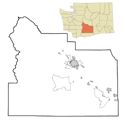
Buena, Washington
Buena, Washington | |
|---|---|
| Coordinates: 46°25′43″N 120°18′48″W / 46.42861°N 120.31333°W | |
| Country | United States |
| State | Washington |
| County | Yakima |
| Elevation | 794 ft (242 m) |
| Population (2010) | |
| • Total | 990 |
| Time zone | UTC-8 (Pacific (PST)) |
| • Summer (DST) | UTC-7 (PDT) |
| ZIP code | 98921 |
| Area code | 509 |
| GNIS feature ID | 1512046[1] |
Buena is an unincorporated community in Yakima County, with a 2010 census population of 990. The community was not recognized in the 2000 census figures. Washington, United States. Buena is 3.5 miles (5.6 km) north of Toppenish. Buena has a post office with ZIP code 98921.[2]
References
- ^ U.S. Geological Survey Geographic Names Information System: Buena, Washington
- ^ ZIP Code Lookup Archived September 12, 2012, at the Wayback Machine


