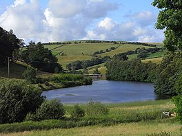
Chapelhouse Reservoir
Appearance
| Chapelhouse Reservoir | |
|---|---|
 Chapelhouse Reservoir | |
| Location | Cumbria |
| Coordinates | 54°42′35″N 3°8′57″W / 54.70972°N 3.14917°W |
| Type | reservoir |
| Basin countries | United Kingdom |
| Max. length | 0.27 mi (0.44 km) |
Chapelhouse Reservoir is a water reservoir near Uldale in Cumbria.
History
The reservoir, which is around 435 meters long, was built by John Laing & Son in around 1900.[1] It involved damming the River Ellen above Uldale to provide water for Aspatria and Silloth.[1] It is named after Chapelhouse Farm which is close by and it is owned by United Utilities.[2]
References
- ^ a b Ritchie, p. 26
- ^ "Chapelhouse Reservoir". Lakes, meres, tarns & waters. Retrieved 12 September 2015.
