Luttelgeest
Luttelgeest | |
|---|---|
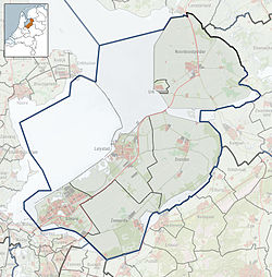
Location of Luttelgeest in the province of Flevoland | |
| Coordinates: 52°44′35″N 5°51′9″E / 52.74306°N 5.85250°E | |
| Country | Netherlands |
| Province | Flevoland |
| Municipality | Noordoostpolder |
| Population (2007) | 2,350 |
Luttelgeest (52°45′N 5°51′E / 52.750°N 5.850°E) is a village in the Dutch province of Flevoland. It is a part of the municipality of Noordoostpolder, and was created in 1950 as one of ten planned villages around the new city of Emmeloord.
In 2001, Luttelgeest had 681 inhabitants. The built-up area of the village was 0.16 km², and contained 278 residences.[1]
Public transportation
There is no railway station in Luttelgeest, but the nearest stations are in Kampen and Steenwijk.
References
- ^ Statistics Netherlands (CBS), Bevolkingskernen in Nederland 2001 "Archived copy". Archived from the original on 2006-03-19. Retrieved 2007-01-24.
{{cite web}}: CS1 maint: archived copy as title (link). Statistics are for the continuous built-up area.

