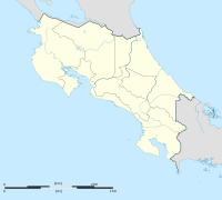
Quebrada Grande District
Appearance
Quebrada Grande | |
|---|---|
District | |
| Coordinates: 10°25′49″N 84°56′40″W / 10.43021°N 84.94453°W | |
| Country | |
| Province | Guanacaste Province |
| Canton | Tilarán |
| Area | |
| • Total | 33.72 km2 (13.02 sq mi) |
| Time zone | UTC-6 (UTC -6) |
| Postal code | 50802 |
Quebrada Grande is a district in Tilarán Canton in the Guanacaste Province, Costa Rica.[1][2]
Toponymy
The translation to english of Quebrada Grande is Big Creek, a self explanatory name of a riverine feature in the area.
History
On 11 June 2020, the Cabeceras district was segregated from Quebrada Grande, by allocating 51.25 km2 (19.79 sq mi) from the originally 85.24 km2 (32.91 sq mi) of Quebrada Grande. [3]
References
- ^ "DISTRIBUCIÓN DE JUNTAS RECEPTORAS DE VOTOS" (PDF). Tribunal Supremo de Electiones. 2018. Retrieved 28 January 2019.
- ^ "Postal Codes of Costa Rica". 1costarica. Retrieved 28 January 2019.
- ^ Marín, Claudia (11 June 2020). "Aprueban creación del distrito octavo del cantón de Tilarán". elmundo.cr. Retrieved 12 June 2020.

