Langeweide
Appearance
Langeweide | |
|---|---|
Hamlet | |
 Voormalig gemeentehuis Lange Ruige Weide | |
 | |
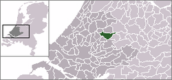
 Location of Langeweide in the municipality of Reeuwijk. | |
| Coordinates: 52°01′56″N 4°47′58″E / 52.03222°N 4.79944°E | |
| Country | Netherlands |
| Province | South Holland |
| Municipality | Bodegraven-Reeuwijk |
| Population (2007) | |
| • Total | 100 |
| Time zone | UTC+1 (CET) |
| • Summer (DST) | UTC+2 (CEST) |
Langeweide is a hamlet in the Dutch province of South Holland. It is a part of the former municipality of Reeuwijk, and lies about 6 km east of Gouda.[1]
References
- ^ ANWB Topografische Atlas Nederland, Topografische Dienst and ANWB, 2005.
