Oloosson
39°53′55″N 22°11′15″E / 39.8987°N 22.1875°E

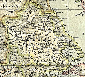
Oloosson (Ancient Greek: Ὀλοοσσών)[1] was a town and polis (city-state)[2] of Perrhaebia in ancient Thessaly near Elone and Gonnus,[3] mentioned in the Catalogue of Ships in the Iliad by Homer, who gives to it the epithet of “white,” from its white argillaceous soil.[4] In Procopius the name occurs in the corrupt form of Lossonus.[5]
Several Greek inscriptions have been found concerning the city of Oloosson. In a votive inscription from the first half of the fourth century BCE that is dedicated to Apollo Pythius are also the names of some people together with various demonyms from Perrhaebia.[6] In another inscription dated in the 1st century BCE, election procedures of magistrates are mentioned.[7]
Ancient Oloosson was located at a site called Panayia in the modern town of Elassona.[8][9]
References
- ^ Stephanus of Byzantium. Ethnica. Vol. s.v.
- ^ Mogens Herman Hansen & Thomas Heine Nielsen (2004). "Thessaly and Adjacent Regions". An inventory of archaic and classical poleis. New York: Oxford University Press. p. 725. ISBN 0-19-814099-1.
- ^ Strabo. Geographica. Vol. ix. p.440. Page numbers refer to those of Isaac Casaubon's edition.
- ^ Homer. Iliad. Vol. 2.739.
- ^ Procop. de Aedif. 4.14
- ^ Jorge Martínez de Tejada Garaizábal, Instituciones, sociedad, religión y léxico de Tesalia de la antigüedad desde la época de la independencia hasta el fin de la edad antigua (siglos VIII AC-V DC), tesis doctoral, p.794. Madrid: Universidad Complutense de Madrid (2012).
- ^ Jorge Martínez de Tejada Garaizábal, Instituciones, sociedad, religión y léxico de Tesalia de la antigüedad desde la época de la independencia hasta el fin de la edad antigua (siglos VIII AC-V DC), tesis doctoral, p.226. Madrid: Universidad Complutense de Madrid (2012)., where the inscription is identified with the denomination IG (9) 2.1292.
- ^ Richard Talbert, ed. (2000). Barrington Atlas of the Greek and Roman World. Princeton University Press. p. 55, and directory notes accompanying. ISBN 978-0-691-03169-9.
- ^ Lund University. Digital Atlas of the Roman Empire.
![]() This article incorporates text from a publication now in the public domain: Smith, William, ed. (1854–1857). "Oloosson". Dictionary of Greek and Roman Geography. London: John Murray.
This article incorporates text from a publication now in the public domain: Smith, William, ed. (1854–1857). "Oloosson". Dictionary of Greek and Roman Geography. London: John Murray.
