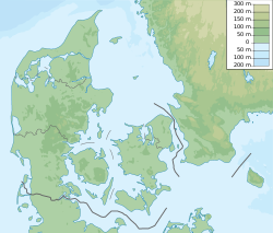
Borup, Køge Municipality
Borup | |
|---|---|
town | |
 Borup church | |
| Coordinates: 55°29′45″N 11°58′40″E / 55.49592°N 11.97789°E | |
| Country | Denmark |
| Region | Zealand (Sjælland) |
| Municipality | Køge |
| Area | |
| • Urban | 2.61 km2 (1.01 sq mi) |
| Population (2020) | |
| • Urban | 4,647 |
| • Urban density | 1,800/km2 (4,600/sq mi) |
| • Gender | 2,312 males and 2,335 females |
| Time zone | UTC+1 (CET) |
| • Summer (DST) | UTC+2 (CEST) |
| Postal code | DK-4140 Borup |
Borup, in Køge Municipality, 40 km southwest of Copenhagen, Denmark, is a railway town on the railroad between Roskilde and Ringsted. With a population of 4,647 (1 January 2020),[1] it is the second largest town of the municipality.

Geography
Borup is in east central Zealand, 14 km west of Køge, 11 km northeast of Ringsted, and 18 km southwest of Roskilde - between the two small lakes Borup Lake (Danish: Borup Sø) on the western outskirts of the town and the larger Kimmerslev Lake (Danish: Kimmerslev Sø) on the southeastern outskirts.
History
In 1967, Borup was known for an air-raid shelter built in the town by the doomsday cult The Orthon cult.[2]
On 1 April 1970, Borup became the municipal seat of Skovbo Municipality, until it was merged with Køge Municipality on 1 January 2007.
Notable people
- Frede Christoffersen (1919 in Borup – 1987) a Danish painter and illustrator
- Jakob Glerup (born 1975 in Borup) a former Danish football midfielder, played 454 games for Viborg FF
References
- ^ BY3: Population 1st January, by urban areas The Mobile Statbank from Statistics Denmark
- ^ "Skeptic Report: The Orthon cult - Doomsday in Denmark 1967". Archived from the original on 2011-08-13. Retrieved 2011-03-28.


