
Wissenkerke
Wissenkerke | |
|---|---|
Village | |
 Flag  Coat of arms | |
 | |
 The village centre (dark green) and the statistical district (light green) of Wissenkerke in the municipality of Noord-Beveland. | |
| Coordinates: 51°35′4″N 3°44′48″E / 51.58444°N 3.74667°E | |
| Country | Netherlands |
| Province | Zeeland |
| Municipality | Noord-Beveland |
| Population (1 January 2008) | |
| • Total | 1,078 |
| Time zone | UTC+1 (CET) |
| • Summer (DST) | UTC+2 (CEST) |
Wissenkerke is a village in the Dutch province of Zeeland. It is a part of the municipality of Noord-Beveland, and lies about 20 km northeast of Middelburg.
In 1816, the village of Kampensnieuwland was merged into Wissenkerke.[1] Wissenkerke then remained a separate municipality until 1995.[1]
In 2001, the village of Wissenkerke had 1045 inhabitants. The built-up area of the village was 0.29 km², and contained 466 residences.[2] The statistical area "Wissenkerke", which also can include the surrounding countryside, has a population of around 1100.[3]
Gallery
-
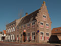 Monumental house
 -
 Windmill: korenmolen de Onderneming
 -
 Former windmill: korenmolen het Landzigt


See also
References
- ^ a b Ad van der Meer and Onno Boonstra, Repertorium van Nederlandse gemeenten, KNAW, 2011.
- ^ Statistics Netherlands (CBS), Bevolkingskernen in Nederland 2001 [1]. (Statistics are for the continuous built-up area).
- ^ Statistics Netherlands (CBS), Statline: Kerncijfers wijken en buurten 2003-2005 [2]. As of 1 January 2005.
This article about a location in Zeeland is a stub. You can help Wikipedia by expanding it. |