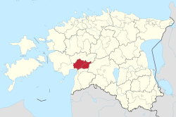
Tori Parish
Appearance
Tori Parish
Tori vald | |
|---|---|
 Iisaar "sacred grove" island | |
 Tori Parish within Pärnu County. | |
| Country | |
| County | |
| Administrative centre | Tori |
| Area | |
| • Total | 282.1 km2 (108.9 sq mi) |
| Population (01.01.2006) | |
| • Total | 2,538 |
| • Density | 9.0/km2 (23/sq mi) |
| Website | www.torivald.ee |
Tori is a municipality located in Pärnu County[1], one of the 15 counties of Estonia.[2]
References
- ^ Latitude.to. "GPS coordinates of Tori Parish, Estonia. Latitude: 58.4833 Longitude: 24.8167". Latitude.to, maps, geolocated articles, latitude longitude coordinate conversion. Retrieved 2020-07-27.
- ^ "Estonia Counties". www.statoids.com. Retrieved 2020-07-27.
58°29′N 24°49′E / 58.483°N 24.817°E


