
Svatý Mikuláš
Svatý Mikuláš | |
|---|---|
.jpg) Saint Nicholas Church | |
 Flag  Coat of arms | |
 Svatý Mikuláš Location in the Czech Republic | |
| Coordinates: 49°59′27″N 15°21′2″E / 49.99083°N 15.35056°E | |
| Country | |
| Region | Central Bohemian |
| District | Kutná Hora |
| First mentioned | 1307 |
| Area | |
| • Total | 17.82 km2 (6.88 sq mi) |
| Elevation | 206 m (676 ft) |
| Population (2020-01-01[1]) | |
| • Total | 875 |
| • Density | 49/km2 (130/sq mi) |
| Time zone | UTC+1 (CET) |
| • Summer (DST) | UTC+2 (CEST) |
| Postal code | 285 31, 285 74 |
| Website | www |
Svatý Mikuláš is a municipality and village in the Kutná Hora District in the Central Bohemian Region of the Czech Republic. It has about 900 inhabitants.
Gallery
-
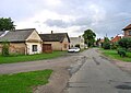 West common
 -
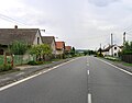 Road No 2


References
- ^ "Population of Municipalities – 1 January 2020". Czech Statistical Office. 2020-04-30.
Wikimedia Commons has media related to Svatý Mikuláš (Kutná Hora District).
| International | |
|---|---|
| National | |