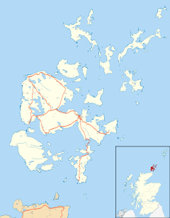
Toab, Orkney
Appearance
| Toab | |
|---|---|
 Converted farmhouse, Toab | |
Location within Orkney | |
| OS grid reference | HY510069 |
| Civil parish | |
| Council area | |
| Lieutenancy area | |
| Country | Scotland |
| Sovereign state | United Kingdom |
| Post town | ORKNEY |
| Postcode district | KW17 |
| Dialling code | 01856 |
| Police | Scotland |
| Fire | Scottish |
| Ambulance | Scottish |
| UK Parliament | |
| Scottish Parliament | |
Toab is a parish on the Orkney Mainland.
Toab is located off the A960 road at the head of Deer Sound on the Mainland, Orkney Islands, Scotland. It is in the parish of St Andrews – along with Tankerness – it is thought its name derives from the Norse phrase for the place where visiting ships had to pay a toll.[1]
People from Toab are known as ‘Toaboggans’
See also
References
- ^ "Orkney Placenames". Orkneyjar. Retrieved 27 May 2008.
External links
Wikimedia Commons has media related to Toab, Orkney Islands.
- Map sources for Toab, Orkney

