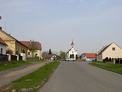
Stará Huť
Appearance
Stará Huť | |
|---|---|
 Centre of Stará Huť | |
| Coordinates: 49°46′56″N 14°11′51″E / 49.78222°N 14.19750°E | |
| Country | |
| Region | Central Bohemian |
| District | Příbram |
| Founded | 1674 |
| Area | |
| • Total | 8.26 km2 (3.19 sq mi) |
| Elevation | 352 m (1,155 ft) |
| Population (2020-01-01[1]) | |
| • Total | 1,503 |
| • Density | 180/km2 (470/sq mi) |
| Time zone | UTC+1 (CET) |
| • Summer (DST) | UTC+2 (CEST) |
| Postal code | 262 02 |
| Website | www |
Stará Huť is a municipality and village in Příbram District in the Central Bohemian Region of the Czech Republic. It has about 1,500 inhabitants.
History
It was founded around 1674, originally for the purposes of metallurgy. The name literally means Old Smelter.
Economy and tourism
While the landscape is reported to be not fruitful and therefore not suitable for agriculture, it is a popular place for hiking.
Notable people
Karel Čapek, a Czech writer, was fascinated by local landscape and he spent much time working and relaxing in his local summer residence in the latter half of the 1930s.
Present
Currently the municipality is developing with some new housing settlements on offer in the vicinity.
References
- ^ "Population of Municipalities – 1 January 2020". Czech Statistical Office. 2020-04-30.
External links
- Towns and Communities Online Portal village Stará Huť (in Czech)
- Official website (Czech)
Wikimedia Commons has media related to Stará Huť.


