
Luib, Skye
Luib
| |
|---|---|
 The settlement of Luib seen from a descent of Glas Bheinn Mhor. Blue sky and blue seas on a brilliant February day. | |
 Luib Location within the Isle of Skye | |
| OS grid reference | NG564279 |
| Council area | |
| Country | Scotland |
| Sovereign state | United Kingdom |
| Postcode district | IV49 9 |
| Police | Scotland |
| Fire | Scottish |
| Ambulance | Scottish |
Luib (Scottish Gaelic: Lùib) is a crofting and fishing settlement on the south east shore of the sea loch, Loch Ainort near Broadford, on the island of Skye in Scotland.[1] It is in the council area of Highland.The settlement of Dunan is 1 mile (1.5 kilometres) directly east of Luib, along the A87 coast road.
Gallery
-
-
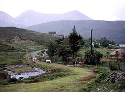
 Luib folk museum
 -
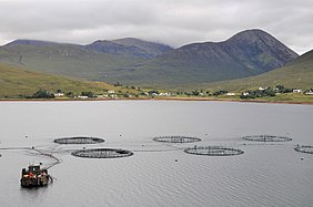 Luib seen from across Loch Ainort


References
Wikimedia Commons has media related to Luib, Isle of Skye.
This Highland location article is a stub. You can help Wikipedia by expanding it. |