Hikueru Airport
Appearance
Hikueru Airport | |||||||||||
|---|---|---|---|---|---|---|---|---|---|---|---|
| Summary | |||||||||||
| Airport type | Public | ||||||||||
| Operator | DSEAC Polynésie française | ||||||||||
| Serves | Tupapati, Hikueru, Tuamotus, French Polynesia | ||||||||||
| Elevation AMSL | 5 m / 16 ft | ||||||||||
| Coordinates | 17°32′52″S 142°36′46″W / 17.54778°S 142.61278°W | ||||||||||
| Map | |||||||||||
| Runways | |||||||||||
| |||||||||||
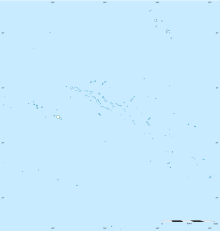
Hikueru Airport (IATA: HHZ, ICAO: NTGH) is an airport on the atoll of Hikueru, part of the Tuamotu Archipelago in French Polynesia. The airport is adjacent to the village of Tupapati.
Airlines and destinations
| Airlines | Destinations |
|---|---|
| Air Tahiti | Hao, Papeete[4] |
References
- ^ NTGH – Hikueru. AIP from French Service d'information aéronautique, effective 11 July 2024.
- ^ Airport information for HHZ at Great Circle Mapper.
- ^ Airport information for Hikueru Airport at Transport Search website.
- ^ Liu, Jim. "Air Tahiti adds new domestic sectors in NS20". Routesonline. Retrieved 14 February 2020.

