Berbice Bridge
Appearance
Berbice Bridge | |
|---|---|
 The Berbice Bridge under construction in 2007 | |
| Coordinates | 6°16′52″N 57°31′44″W / 6.281°N 57.529°W |
| Carries | 2-lane wide highway |
| Crosses | Berbice River |
| Locale | North east Berbice |
| Characteristics | |
| Total length | 1,571 m |
| History | |
| Opened | 23 December 2008 |
| Statistics | |
| Toll | yes |
| Location | |
 | |
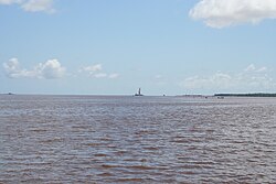
The Berbice Bridge is a pontoon bridge over the Berbice River near New Amsterdam in Guyana. The bridge is tolled and was opened on 23 December 2008.[1]
With the completion of the Berbice Bridge, and the earlier completion of the Coppename Bridge in Suriname in 1999, the Courantyne River is the only river between the Guyanese capital of Georgetown and the Surinamese capital of Paramaribo still left without a bridge. This is due to change in the near future, with plans for a bridge on the Courantyne near South Drain becoming increasingly concrete in January 2011.[2] The bridge doesn't have a pedestrian crossing.
See also
References
- ^ Stabroek News - Berbice bridge opened, 24 December 2008
- ^ Dagblad Suriname - OW-minister en Ballast Nedam bekijken locatie Corantijnbrug, 27 January 2018 (in Dutch)
