Dolge Njive, Gorenja Vas–Poljane
Appearance
Dolge Njive | |
|---|---|
 Dolge Njive | |
| Coordinates: 46°3′26.21″N 14°11′43.23″E / 46.0572806°N 14.1953417°E | |
| Country | |
| Traditional region | Upper Carniola |
| Statistical region | Upper Carniola |
| Municipality | Gorenja Vas–Poljane |
| Area | |
• Total | 0.90 km2 (0.35 sq mi) |
| Elevation | 657.9 m (2,158.5 ft) |
| Population (2002) | |
• Total | 59 |
| [1] | |
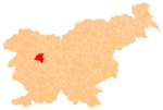
Dolge Njive (pronounced [ˈdoːu̯ɡɛ ˈnjiːʋɛ]) is a small settlement next to Lučine in the Municipality of Gorenja Vas–Poljane in the Upper Carniola region of Slovenia.[2]
Name
The name Dolge Njive means 'long fields', referring to agricultural arrangements in the area. Dolge Njive was attested in historical sources as Dolgonibo in 1291 and Dolgeniue in 1500.[3]
References
- ^ Statistical Office of the Republic of Slovenia
- ^ Gorenja Vas–Poljane municipal site
- ^ "Dolge Njive". Slovenska historična topografija. ZRC SAZU Zgodovinski inštitut Milka Kosa. Retrieved September 10, 2020.
External links


