Ligny
Appearance
Ligny
Ligné | |
|---|---|
Village | |
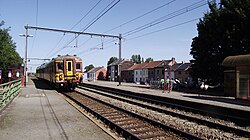
 Ligny Station | |
| Coordinates: 50°30′43″N 4°34′29″E / 50.51194°N 4.57472°E | |
| Country | |
| Province | Namur |
| Municipality | Sombreffe |
| Area | |
| • Total | 5.89 km2 (2.27 sq mi) |
| Time zone | UTC+1 (CET) |
Ligny (in Walloon Ligné) is a village in the municipality of Sombreffe (in the province of Namur), Wallonia Region, Belgium. It is known as the site of the Battle of Ligny, where Napoleon defeated Blücher two days before the battle of Waterloo while Wellington and Marshal Ney were engaged at Quatre Bras.
References
- ^ "Sombreffe (Municipality, Province of Namur, Belgium)". crwflags.com. 2015. Retrieved 31 March 2016.
![]() This article incorporates text from a publication now in the public domain: Wood, James, ed. (1907). "Ligny". The Nuttall Encyclopædia. London and New York: Frederick Warne.
This article incorporates text from a publication now in the public domain: Wood, James, ed. (1907). "Ligny". The Nuttall Encyclopædia. London and New York: Frederick Warne.

