Tugyl
Appearance
Tugyl
Тұғыл | |
|---|---|
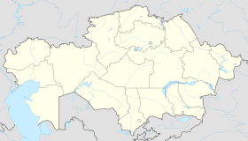
| Coordinates: 47°43′42.6″N 84°12′16.96″E / 47.728500°N 84.2047111°E | |
| Country | |
| Region | East Kazakhstan Region |
| District | Tarbagatay District |
| Population (2009) | |
• Total | 4,744 |
| Time zone | UTC+6 (+6) |
| Post code | 071515 |
Tugyl (Template:Lang-kk) is a village in the Tarbagatay District of the East Kazakhstan Region. The administrative center of the Tugyl rural district. It is located approximately 105 km east of the regional center, the village of Aksuat. Before 1992, the village was called Priozyornoe.[1]
The largest enterprise in Kazakhstan for fishing and production of fish products Jaisanbalyq is located in the village.[2]
Population
In 1999, the population of the village was 7,483 people. According to this census in 2009, 4,744 people lived in the village.[3]
References
- ^ "О переименовании и упорядочении транскрибирования на русском языке наименований отдельных административно-территориальных единиц Республики Казахстан - ИПС "Әділет"". adilet.zan.kz (in Russian). Retrieved 2020-10-01.
{{cite web}}: CS1 maint: url-status (link) - ^ Аяған, Бүркітбай (2005). Казахстан. Национальная энциклопедия (in Russian). Almaty: Kазак энциклопедиясы. p. 266. ISBN 9965-9746-4-0.
- ^ Население Республики Казахстан Итоги Национальной переписи населения Республики Казахстан 2009 года Том 1. Astana: Агентство Республики Казахстан по статистике. 2011.


