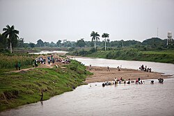
Dajabón River
Appearance
| Dajabón River | |
|---|---|
 | |
| Location | |
| Countries | Dominican Republic and Haiti |
The Dajabón River (also called Massacre River) (French: Rivière du Massacre; Spanish: río Masacre) is a river of the Dominican Republic. It forms the northernmost part of the international border between the Dominican Republic and Haiti.
The river got the name "Massacre River" because it was the site of the killing of thirty French buccaneers by Spanish settlers in 1728.[citation needed] The name became newly popular after being the site of many killings during the Parsley Massacre—though the event was not, contrary to popular belief, the origin of its name.
See also
References
- The Columbia Gazetteer of North America. 2000.
- GEOnet Names Server
- CIA map
19°42′07″N 71°45′31″W / 19.70194°N 71.75861°W
