Sesori
Appearance
Sesori | |
|---|---|
Municipality | |
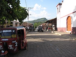
 Ciudad de Sesori downtown | |
| Coordinates: 13°43′N 88°22′W / 13.717°N 88.367°W | |
| Country | |
| Department | San Miguel Department |
| Elevation | 700 ft (200 m) |
| Website | facebook.com/sesorences |
Sesori is a municipality in the Department of San Miguel, El Salvador. This is where many of the local people come and get food, supplies, education and it is also here where they get transportation to larger cities. Its location was used by other surrounding villages as people came here to make use of telephone services provided by ANTEL (Administracion Nacional de Telecomunicaciones).


